Frequency
There will be services to the city every 10 minutes at peak times, and every 30 minutes off-peak.

In 2025, the Tasmanian Government completed a strategic planning activity (known as a Strategic Business Case) to inform options for improving public transport accessibility, reducing congestion and supporting urban development outcomes across Greater Hobart.
The study recommended a rapid bus network for Greater Hobart, with services to the north, south and east connecting with existing buses, ferries and walking and cycling links. The northern suburbs route between Hobart's city centre and Claremont was identified as the priority for further investigation. Detailed investigation is now underway for this route, including design, technical and economic assessments. These investigations will build on the earlier study and test its findings.
The project is still in the planning stage.
A route and station locations have been identified as a basis for further investigation, but the project is still being assessed and many details have not been finalised.
Over the coming months, the project team will continue to undertake technical, environmental and economic analysis. Community feedback will provide important evidence for this work and help test assumptions, identify potential impacts and highlight opportunities.
An initial report will be completed later this year. Subject to government approvals, more detailed planning will continue until mid-2027.
The project is still in the early planning stages and can only progress if it receives approval from the Australian and Tasmanian Governments and funding is secured.
The engagement program is open from Tuesday 8 September until Friday 9 October 2026.
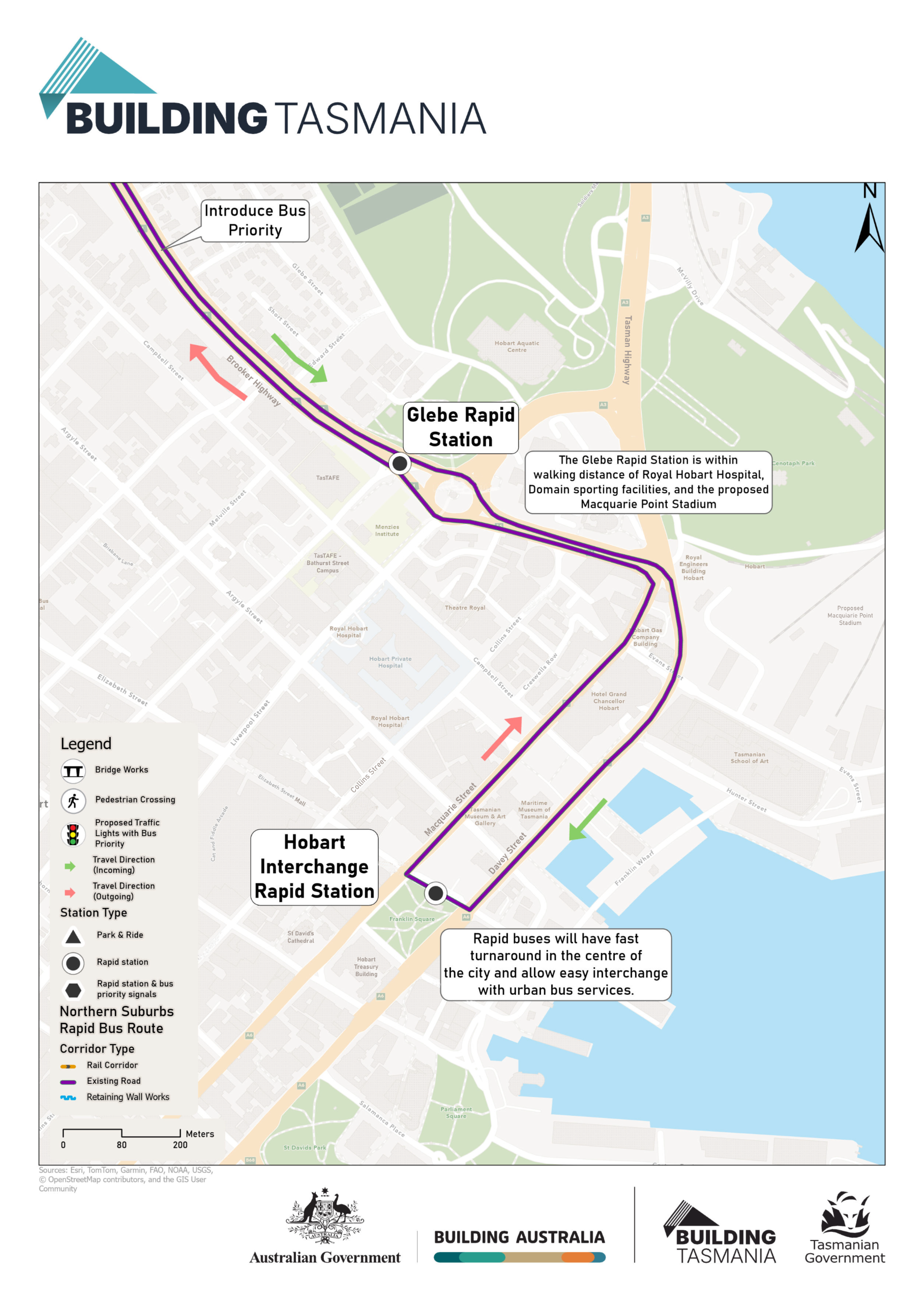
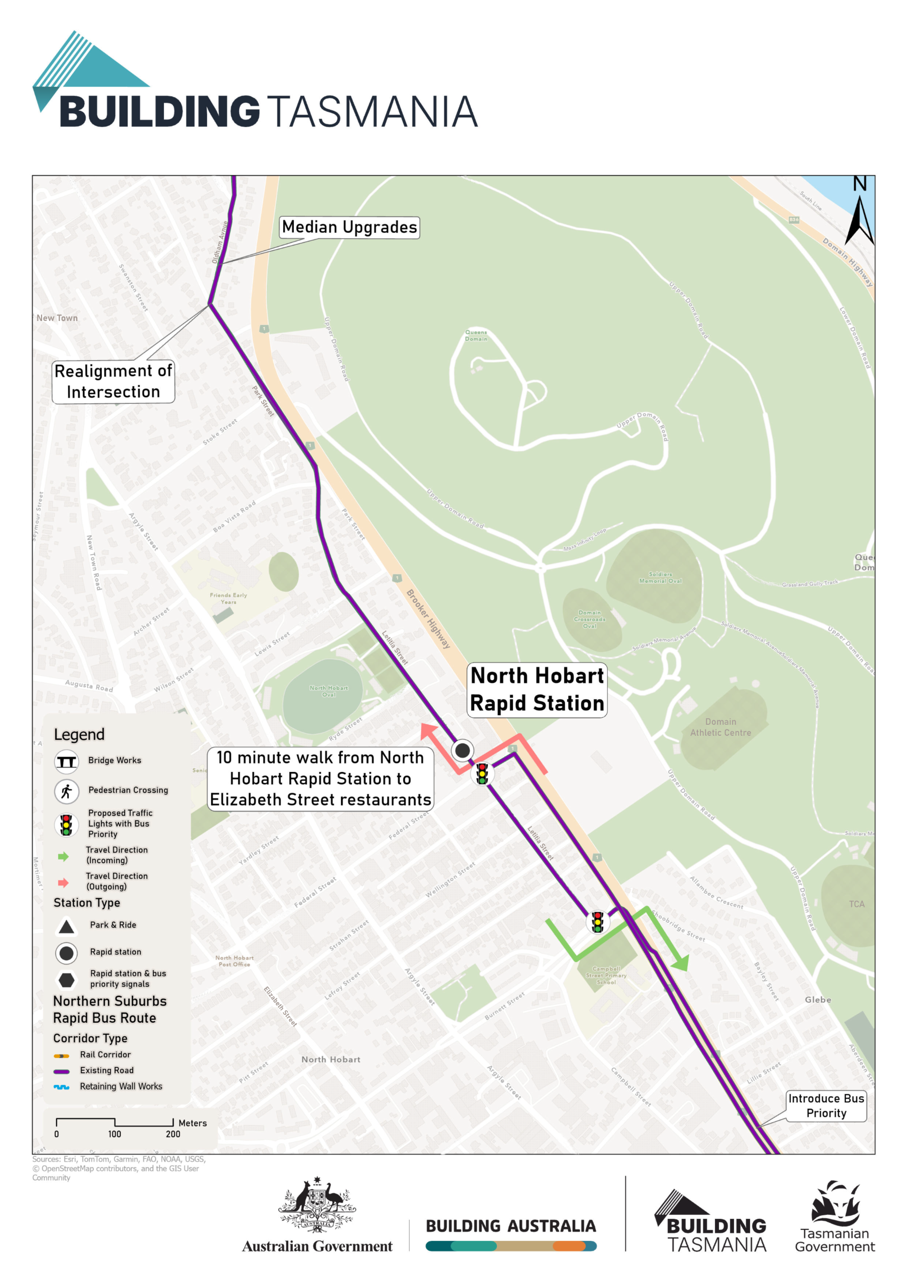
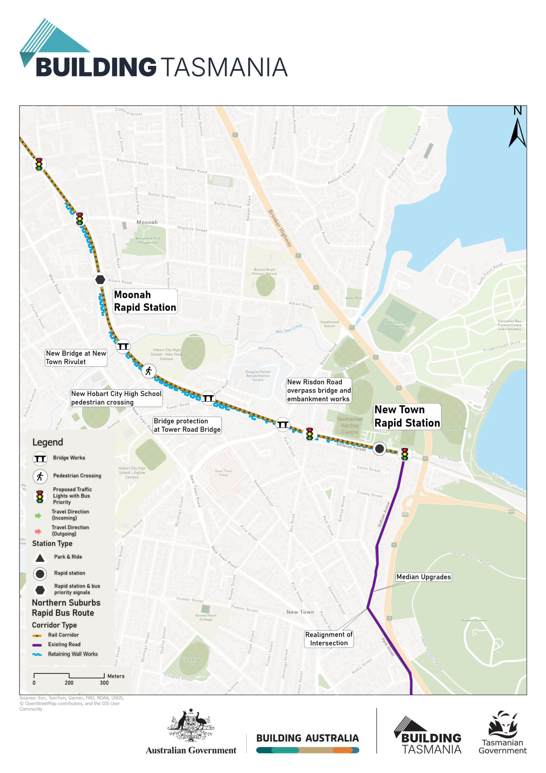
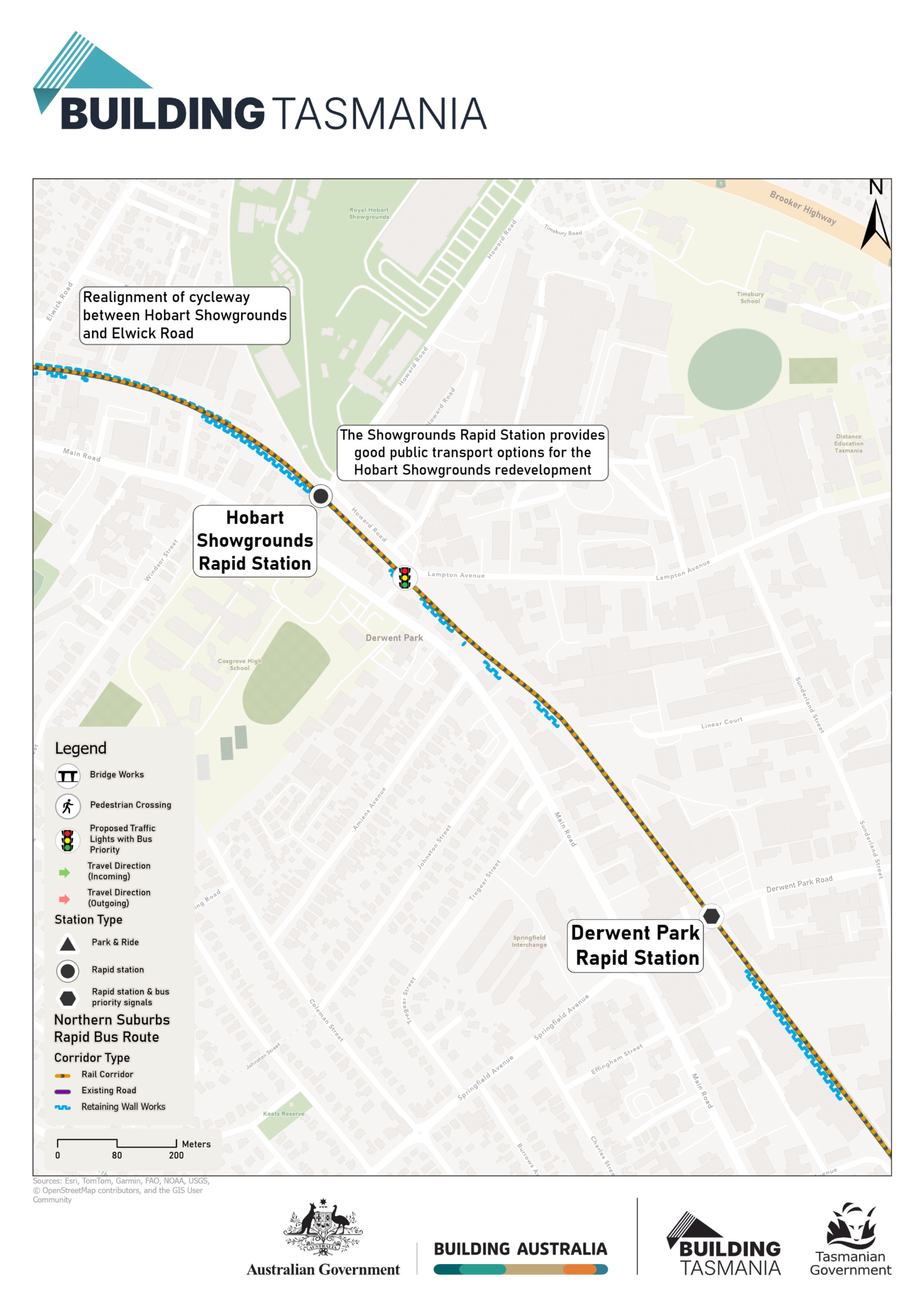
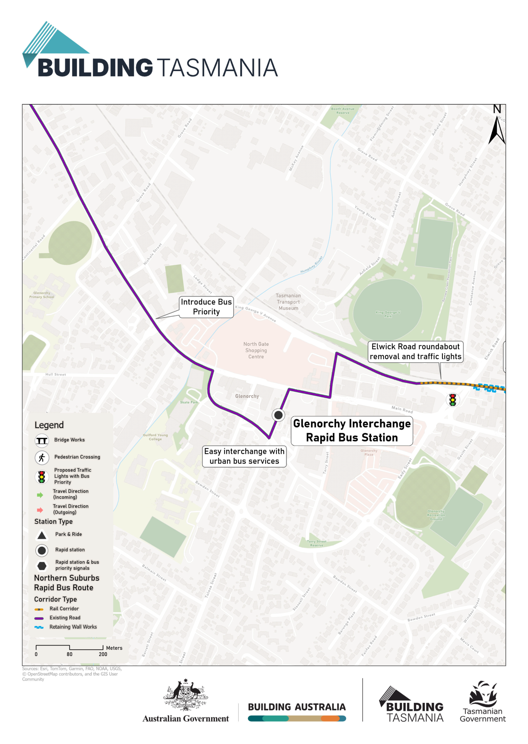
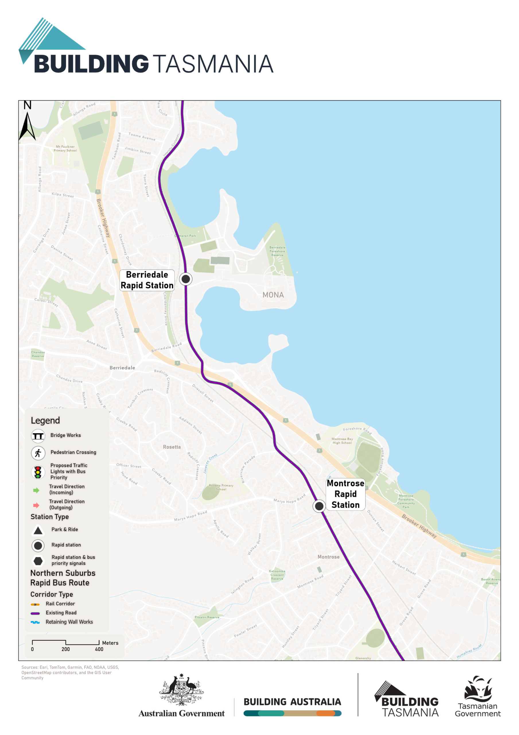
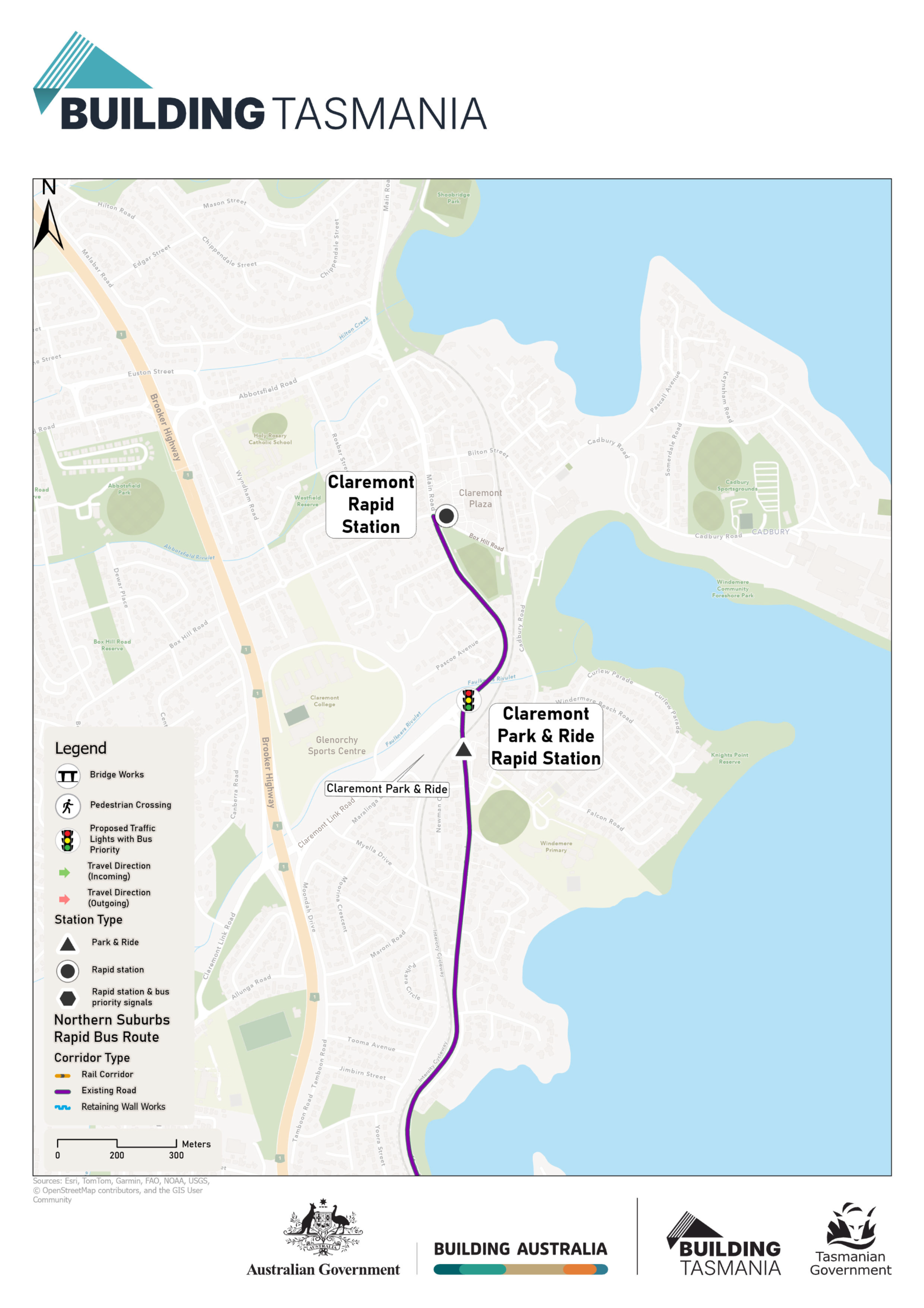
| A number of possible routes were considered during the strategic study. The route for the proposed service uses a combination of existing roads and part of the former rail corridor between New Town and Glenorchy. The study found this option provided a good balance between faster and more reliable public transport, cost, impacts and opportunities to support future development. |
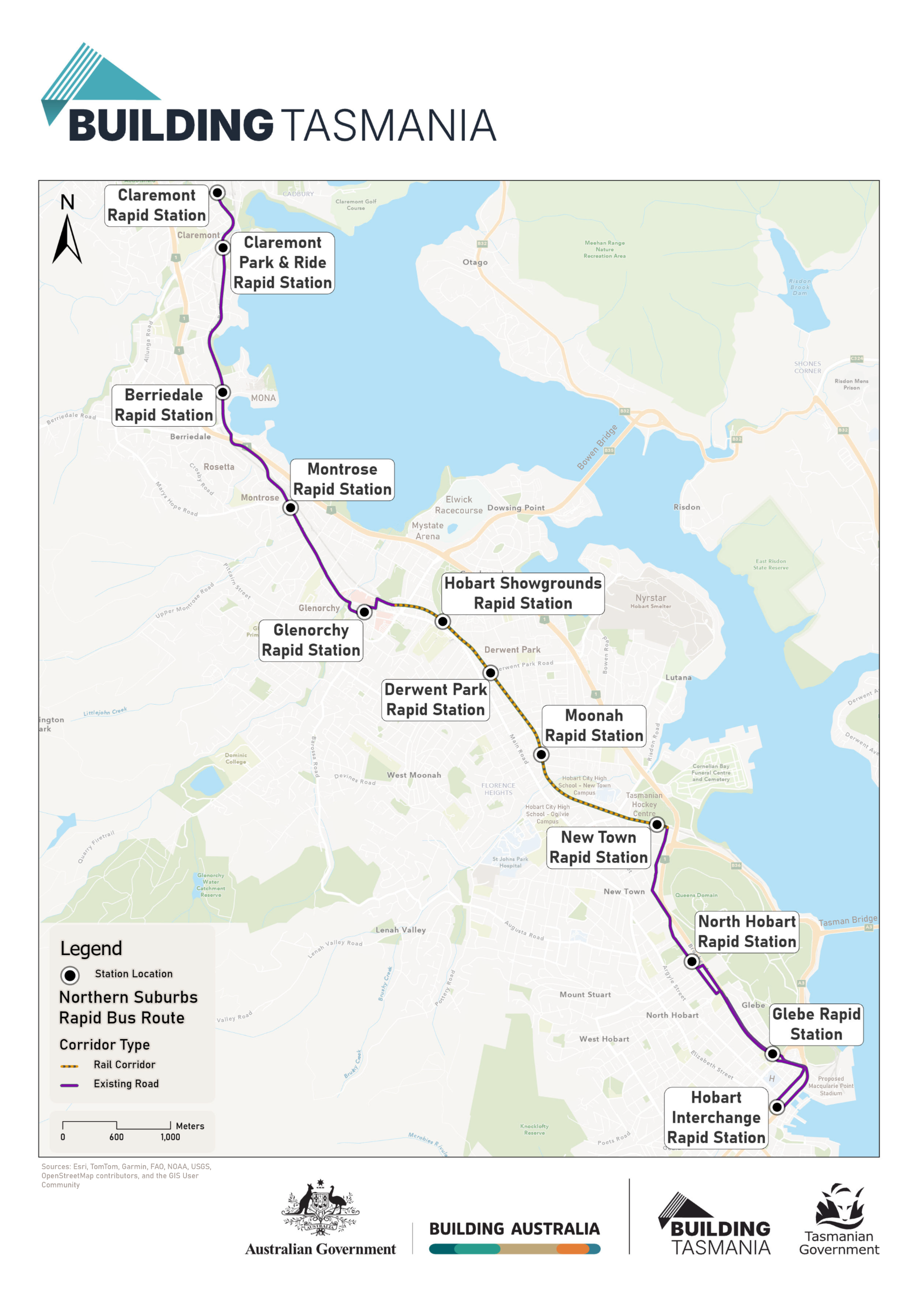
Image 1 of 7
There will be services to the city every 10 minutes at peak times, and every 30 minutes off-peak.
Rapid buses can use dedicated lanes to avoid general traffic and are given priority at intersections to keep services moving efficiently.
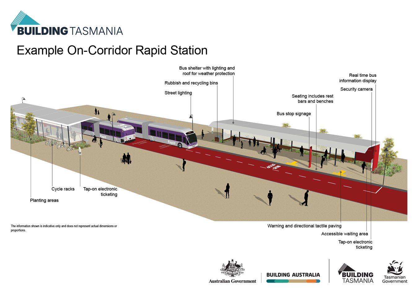
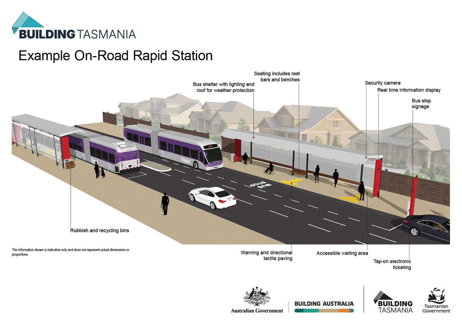
Stations will offer shelter, seating, lighting and real-time information. Each station will be designed to suit its location and provide a safe, welcoming experience for passengers.
Two example stations have been developed to show what they could look like in different locations. Each station will be designed to suit its location and provide a safe, welcoming experience for passengers.
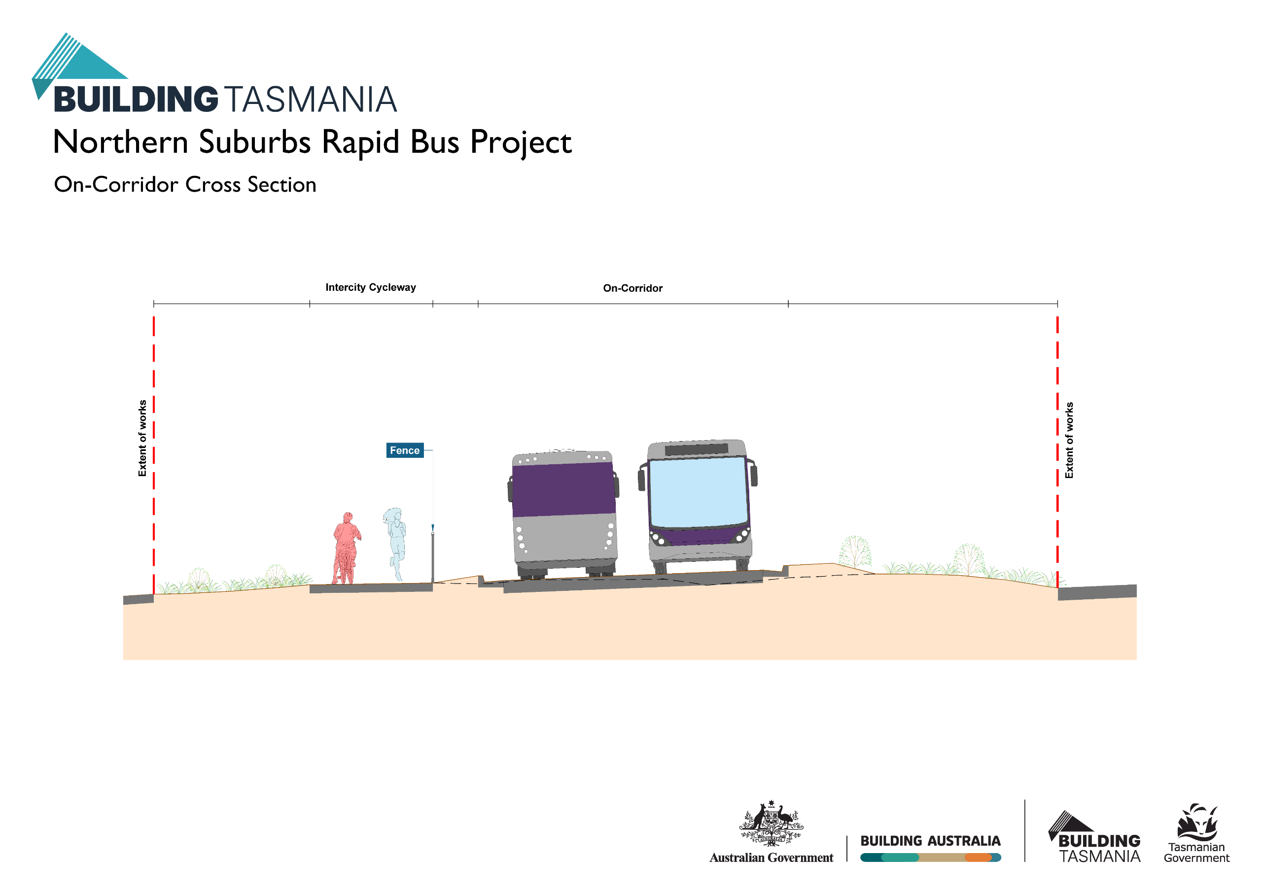
An example illustration has been developed for a cross section of the on-corridor part of the route which is next to the Intercity Cycleway.
The Land Use Survey is an important step in confirming land-use patterns along the Northern Suburbs Transit Corridor and rapid bus route to inform current understanding and future decision-making. The survey was open between mid-July and mid-August 2026.



